EMODnet Human Activities, Environment, World Database on Protected Areas (WDPA)
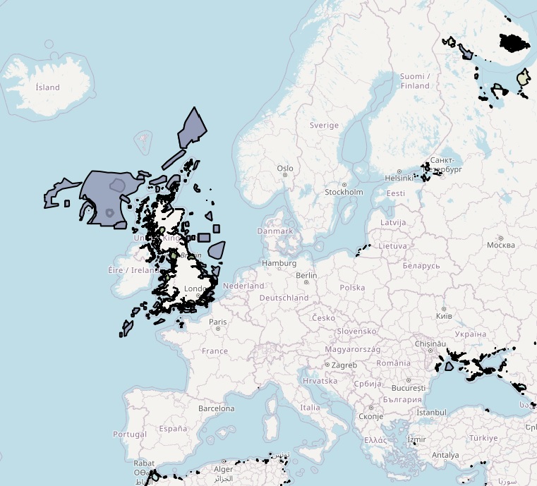
The dataset on coastal and marine protected areas in the European seas for those countries or territories that are not covered by the the EEA's Common Database on Designated Areas (CDDA) was created in 2022 by Cogea for the European Marine Observation and Data Network (EMODnet). It includes polygons and points and it is entirely based on GIS vector data from UNEP-WCMC and IUCN 2023, (Protected Planet: The World Database on Protected Areas, WDPA, [Online], November 2024, Cambridge, UK: UNEP-WCMC and IUCN, available at: www.protectedplanet.net), plus additional info and selected tabular data added as feature attributes, as well as the calculation of marine and coastal location of features. It is available for viewing and download on EMODnet web portal (Human Activities, https://emodnet.ec.europa.eu/en/human-activities). The WDPA is the most comprehensive global database of marine and terrestrial protected areas, it is a joint project between UN Environment Programme (UNEP) and the International Union for Conservation of Nature (IUCN), and it is managed by the UNEP World Conservation Monitoring Centre (UNEP-WCMC), in collaboration with governments, non-governmental organisations, academia and industry. In the webmap the dataset has been filtered in order to show only marine and coastal areas. Geographical coverage: Algeria, Antigua and Barbuda, Barbados, Belize, Colombia, Costa Rica, Cuba, Denmark (only the Faroe Islands), Dominica, Dominican Republic, Egypt, France (only Guadeloupe, Martinique, Saint Barthélemy, Saint Martin French part), Georgia, Grenada, Guatemala, Haiti, Honduras, Israel, Jamaica, Lebanon, Mexico, Monaco, Morocco, Netherlands (only Aruba, Bonaire, Sint Eustatius and Saba, Curaçao, Sint Maarten Dutch part) Nicaragua, Norway (only Svalbard and Jan Mayen), Palestine, Panama, Russian Federation, Saint Kitts and Nevis, Saint Lucia, Saint Vincent and the Grenadines, Trinidad and Tobago, Tunisia, Turkey, Ukraine, United Kingdom (including Anguilla, British Virgin Islands, Cayman Islands, Guernsey, Isle of Man, Jersey, Montserrat), United States (only Puerto Rico, the US Virgin Islands and the US Minor Outlying Islands in the Caribbean Sea), Venezuela. Where available each polygon/point has the following main attributes: country code, territory code, country name, territory name, WDPA ID, name (english and original), designation name (english and original) and type (International, National, Not Applicable, Regional), IUCN category and description (Ia: Strict Nature Reserve; Ib: Wilderness Area; II: National Park; III: Natural Monument or Feature; IV: Habitat/Species Management Area; V: Protected Landscape/ Seascape; VI: Protected area with sustainable use of natural resources; Not applicable; Not assigned; Not reported), marine location (1: predominantly marine; 2: entirely marine), area sqkm (reported, calculated), marine area sqkm (reported, calculated), status (Adopted, Designated, Established, Inscribed, Not Reported, Proposed), government type (Collaborative governance, Federal or national ministry or agency, For-profit organisations, Government-delegated management, Indigenous peoples, Individual landowners, Joint governance, Local communities, Non-profit organisations, Not Reported, Sub-national ministry or agency), ownership type (Communal, For-profit organisations, Individual landowners, Joint ownership, Multiple ownership, Non-profit organisations, Not Reported, State), management authorithy and plan info, marine/coastal location (1). For further information please visit the Protected Planet website. Compared with the previous release, this one includes the updated dataset 'WDPA_Nov2024_Public' published by the WDPA in November 2024.
Simple
- Date (Publication)
- 2022-09-12
- Date (Revision)
- 2024-11-25
- Date (Creation)
- 2022-09-05
- Citation identifier
- EMODnet_HA_WDPA_Nov2024_20241125
- Point of contact
-
Organisation name Individual name Electronic mail address Role Cogea srl
Author United Nations Environment Programme World Conservation Monitoring Centre (UNEP-WCMC)
Resource provider United Nations Environment Programme (UNEP)
Owner International Union for Conservation of Nature (IUCN)
Owner
-
GEMET - INSPIRE themes, version 1.0
-
-
Area management/restriction/regulation zones and reporting units
-
Land cover
-
Protected sites
-
Habitats and biotopes
-
-
GEMET - Concepts, version 3.1
-
-
protected area
-
natural area
-
natural areas protection
-
- Use limitation
-
Re-use of content for commercial or non-commercial purposes is permitted free of charge, provided that the sources (both EMODnet - Human Activities, and the EEA) are acknowledged. EMODnet - Human Activities accepts no responsibility or liability whatsoever for the re-use of content accessible on its website. Copyright holder: European Environment Agency (EEA); Estonian Environmental Register 01.01.2019; ©Finnish Environment Institute, 2018; Land Burgenland, Land Kärnten, Land Niederösterreich, Land Oberösterreich, Land Salzburg, Land Steiermark, Land Tirol, Land Vorarlberg, Stadt Wien aggregated by Austrian Environment Agency.
- Access constraints
- Other restrictions
- Other constraints
-
no limitation
- Spatial representation type
- Vector
- Denominator
- 100000
- Language
- English
- Topic category
-
- Environment
))
- Reference system identifier
- EPSG:4326
- Reference system identifier
- ISO 19108 calendar
- Distribution format
-
Name Version unknown
unknown
- Transfer size
- 0
- OnLine resource
-
Protocol Linkage Name WWW:LINK-1.0-http--link
https://emodnet.ec.europa.eu/en/human-activities EMODnet Human Activities
OGC:WMS-1.3.0-http-get-map
https://ows.emodnet-humanactivities.eu/wms? wdpaareas
OGC:WFS
https://ows.emodnet-humanactivities.eu/wfs? emodnet:wdpaareas
WWW:DOWNLOAD-1.0-http--download
https://ows.emodnet-humanactivities.eu/geonetwork/srv/api/records/f727edd7-87b8-4b02-b173-14ca13025f6f/attachments/EMODnet_HA_Environment_WDPA_%20Nov2024_20241125.zip EMODnet_HA_Environment_WDPA_ Nov2024_20241125.zip
OGC:WFS
https://ows.emodnet-humanactivities.eu/wfs? emodnet:wdpalocations
OGC:WMS-1.3.0-http-get-map
https://ows.emodnet-humanactivities.eu/wms? wdpalocations
- Hierarchy level
- Dataset
Conformance result
- Date (Publication)
- 2008-12-04
- Explanation
-
See the referenced specification
Conformance result
- Date (Publication)
- 2009-12-15
- Explanation
-
See the referenced specification
Conformance result
- Date (Publication)
- 2010-12-08
- Explanation
-
See the referenced specification
- Statement
-
Validation and quality assurance remain up to the primary data sources, i.e. the UNEP-WCMC. The WDPA is compiled in collaboration with a wide range of governmental and non-governmental organizations which submit protected area data to UNEP-WCMC. In order to be included in the database, the data delivered by data providers must comply with specific standards. The Reporting guidelines with full details on methodology are available at http://wcmc.io/WDPA_Manual, the UNEP-WCMC (2019) User Manual for the World Database on Protected Areas and world database on other effective area-based conservation measures: 1.6. UNEP-WCMC: Cambridge, UK. Marine and coastal areas are (i) the predominantly or entirely marine areas (MARINE field value=1 or 2), and (ii) the areas, which even if not identified as predominantly or entirely marine in the WDPA, intersect the coastline or are within a distance of 1 km from the coastline. In both cases the COAST_MAR field value=1. The coastline datasets are available at https://www.eea.europa.eu/data-and-maps/data/eea-coastline-for-analysis-2 for the European continental areas, at https://www.marineregions.org/downloads.php for the areas in the Caribbean Sea.
Metadata
- File identifier
- f727edd7-87b8-4b02-b173-14ca13025f6f XML
- Metadata language
- English
- Character set
- UTF8
- Hierarchy level
- Dataset
- Date stamp
- 2024-12-17T17:44:46.005696Z
- Metadata standard name
-
ISO19115
- Metadata standard version
-
2003/Cor.1:2006
- Metadata author
-
Organisation name Individual name Electronic mail address Role Cogea srl
Point of contact
Overviews
Spatial extent
Provided by
