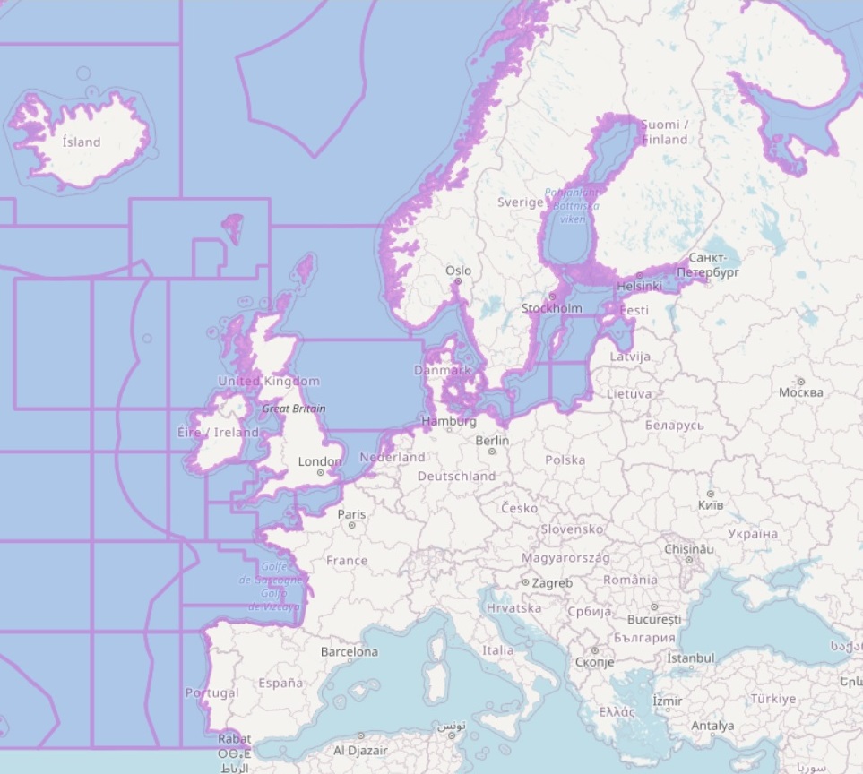
EMODnet Human Activities, ICES Statistical Areas
The ICES Statistical Areas delineates the divisions and subdivisions of FAO Major Fishing area 27.
The ICES Statistical Areas are used as bounding areas for calculation of fish statistics, e.g. catch per unit effort (CPUE) and stock estimates.
Simple
- Date (Creation)
- 2005-11-03
- Citation identifier
- c784a0a3-752f-4b50-b02f-f225f6c815eb
- Point of contact
-
Organisation name Individual name Electronic mail address Role ICES
Originator
-
GEMET - INSPIRE themes, version 1.0
-
-
Statistical units
-
-
GEMET - Concepts, version 3.1
-
-
fishery
-
marine fishery
-
fisheries management
-
- Access constraints
- Other restrictions
- Other constraints
- No limitations on public access
- gmd:useconstraints
- otherRestrictions
- Other constraints
-
Creative Commons CC-BY 4.0 https://creativecommons.org/licenses/by/4.0/
- gmd:useconstraints
- otherRestrictions
- Other constraints
-
This data was downloaded from the EMODnet Portal ( https://emodnet.ec.europa.eu/en/). The data originator is Cogea Srl.
- Language
- English
- Topic category
-
- Boundaries
))
- OnLine resource
-
Protocol Linkage Name WWW:LINK
https://emodnet.ec.europa.eu/en/human-activities EMODnet Human Activities
WWW:DOWNLOAD
https://gis.ices.dk/shapefiles/ICES_areas.zip ICES Statistical Areas
OGC:WMS
https://ows.emodnet-humanactivities.eu/wms? icesareas
OGC:WFS
https://ows.emodnet-humanactivities.eu/wfs? emodnet:icesareas
- Distribution format
-
Name Version Esri shapefile
- Hierarchy level
- Dataset
Conformance result
- Date (Publication)
- 2008-12-04
- Explanation
-
See the referenced specification
Conformance result
- Date (Publication)
- 2009-12-15
- Explanation
-
See the referenced specification
Conformance result
- Date (Publication)
- 2010-12-08
- Explanation
-
See the referenced specification
- Statement
-
-
Metadata
- File identifier
- 4401feb1-7ea7-46ab-9332-deaeb8961ed8 XML
- Metadata language
- English
- Character set
- MD_CharacterSetCode_utf8
- Hierarchy level
- Dataset
- Date stamp
- 2025-09-02T09:35:59.249282Z
- Metadata standard name
-
ISO19115
- Metadata standard version
-
2003/Cor.1:2006
- Metadata author
-
Organisation name Individual name Electronic mail address Role Cogea Srl
Point of contact
Overviews
Spatial extent
Provided by
