EMODnet Human Activities, International Convention Marine Areas
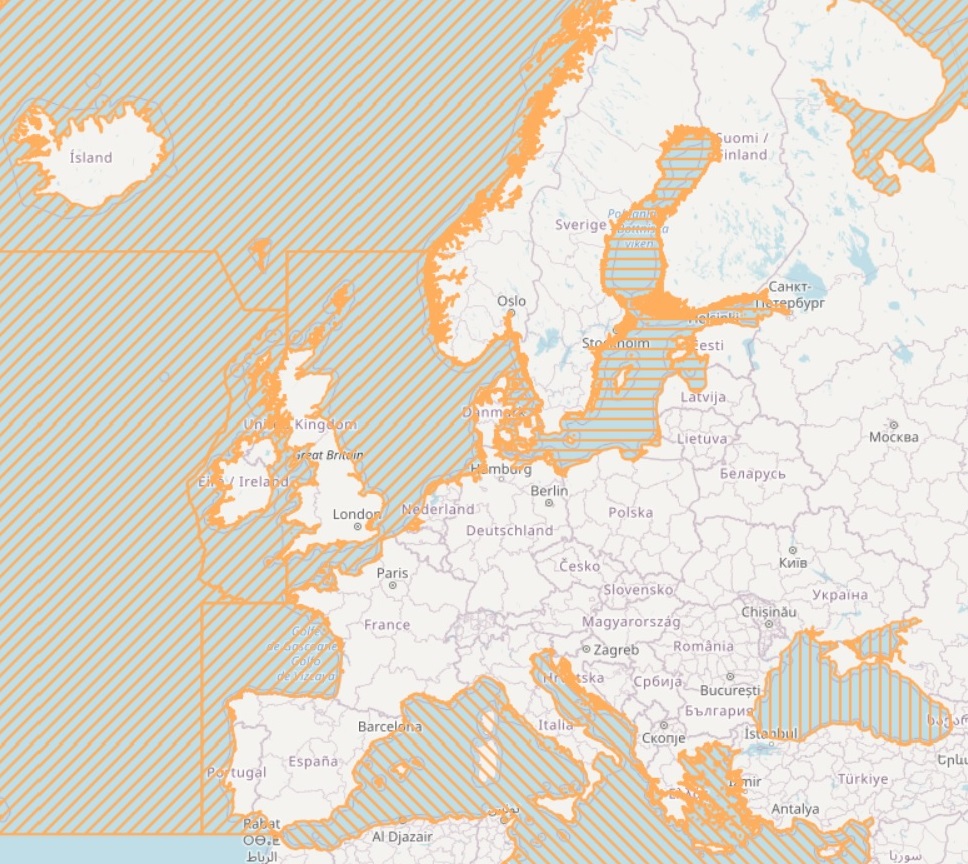
This dataset visualises the marine area with is covered by the Barcelona, Bucharest, HELCOM and OSPAR Convention.
Bucharest Convention dataset was locally created by cutting marine area of Black Sea and Sea of Azov.
HELCOM dataset was downloaded or connect via WMS to http://maps.helcom.fi/ArcGIS/services/DataDelivery/MapServer/WMSServer
Simple
- Date (Creation)
- 2014-04-23
- Citation identifier
- Emodnet_Human_Activities_Others_Managements_WGS84
- Point of contact
-
Organisation name Individual name Electronic mail address Role CETMAR
Author Helsinki Convention
-
GEMET - INSPIRE themes, version 1.0
-
-
Area management/restriction/regulation zones and reporting units
-
-
Poligonal boundaries of Barcelona, Bucharest, HELCOM and OSPAR Convention maritime areas
-
-
International Convention Maritime Areas
-
- Use limitation
-
Re-use of content for commercial or non-commercial purposes is permitted free of charge, provided that the sources (both EMODnet - Human Activities, and primary sources) are acknowledged. EMODnet - Human Activities accepts no responsibility or liability whatsoever for the re-use of content accessible on its website.
- Access constraints
- Other restrictions
- Other constraints
-
no limitation
- Language
- English
- Topic category
-
- Boundaries
))
- Distribution format
-
Name Version unknown
unknown
- OnLine resource
- Hierarchy level
- Dataset
Conformance result
- Date (Publication)
- 2010-12-08
- Explanation
-
See the referenced specification
- Statement
-
The Barcelona Convention marine area shapefile was made by cutting out the "sea area" from a coastline polygon. The edges in the Gibraltar strait and Aegean Sea areas are based on agreed boundaries as defined by the Barcelona Convention.
Bucharest dataset was locally created by cutting of the poligonal boundaries of the Balck Sea and Sea of Azov linecoasts.
The HELCOM marine area shapefile was made by cutting out the "sea area" from a coastline polygon. The edge in the kattegat area is based on agreed boundaries as defined by the HELCOM Combine monitoring programme.An additional feature, a fjord "Schlei" was added to German Baltic Sea coast 8.8.2008Three Danish fjords were added 28.11.2008 from a raster dataset "batymatry", which is product of the EU Interreg project BALANCE.
Validation and quality assurance remain up to primary data sources, while harmonization is carried out by Cogea.
Metadata
- File identifier
- 13660e0c-df72-4920-a5c4-fa092937b5d4 XML
- Metadata language
- English
- Character set
- MD_CharacterSetCode_utf8
- Hierarchy level
- Dataset
- Date stamp
- 2024-02-14T14:06:07.221606Z
- Metadata standard name
-
ISO19115
- Metadata standard version
-
2003/Cor.1:2006
- Metadata author
-
Organisation name Individual name Electronic mail address Role CETMAR
Point of contact
Overviews
Spatial extent
Provided by
