EMODnet Human Activities, FAO Statistical Areas for Fishery Purposes
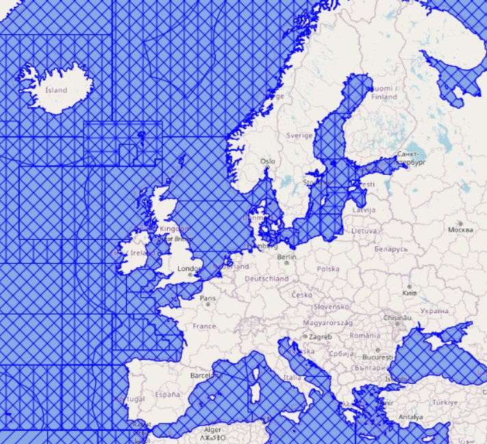
FAO Major Fishing Areas for Statistical Purposes are arbitrary areas, the boundaries of which were determined in consultation with international fishery agencies on various considerations, including (i) the boundary of natural regions and the natural divisions of oceans and seas; (ii) the boundaries of adjacent statistical fisheries bodies already established in inter-governmental conventions and treaties; (iii) existing national practices; (iv) national boundaries; (v) the longitude and latitude grid system; (vi) the distribution of the aquatic fauna; and (vii) the distribution of the resources and the environmental conditions within an area. The rationale of the FAO Major Fishing Areas has been that the areas should, as far as possible, coincide with the areas of competence of other fishery commissions when existing. This system facilitates comparison of data, and improves the possibilities of cooperation in statistical matters in general.
Simple
- Date (Publication)
- 2008-02-15
- Date (Revision)
- 2025-01-27
- Date (Creation)
- 2008-02-15
- Citation identifier
- ac02a460-da52-11dc-9d70-0017f293bd28
- Point of contact
-
Organisation name Individual name Electronic mail address Role FAO - Fisheries Management and Conservation Service
Author
-
GEMET - INSPIRE themes, version 1.0
-
-
Statistical units
-
-
GEMET - Concepts, version 3.1
-
-
fishery
-
marine fishery
-
fisheries management
-
- Access constraints
- Other restrictions
- Other constraints
- No limitations on public access
- gmd:useconstraints
- otherRestrictions
- Other constraints
-
Creative Commons CC-BY 4.0 https://creativecommons.org/licenses/by/4.0/
- gmd:useconstraints
- otherRestrictions
- Other constraints
-
This data was downloaded from the EMODnet Portal ( https://emodnet.ec.europa.eu/en/). The data originator is Cogea Srl.
- Language
- English
- Topic category
-
- Boundaries
))
- OnLine resource
-
Protocol Linkage Name WWW:LINK
https://emodnet.ec.europa.eu/en/human-activities EMODnet Human Activities
OGC:WMS
https://ows.emodnet-humanactivities.eu/wms? fao_areas
OGC:WFS
https://ows.emodnet-humanactivities.eu/wfs? emodnet:fao_areas
WWW:DOWNLOAD
https://ows.emodnet-humanactivities.eu/geonetwork/srv/api/records/0d07002d-4aa1-4215-8915-1979d6ea5226/attachments/EMODnet_HA_FAO_Areas_20230926.zip EMODnet_HA_FAO_Areas_20230926.zip
- Distribution format
-
Name Version Esri shapefile
- Hierarchy level
- Dataset
Conformance result
- Date (Publication)
- 2008-12-04
- Explanation
-
See the referenced specification
Conformance result
- Date (Publication)
- 2009-12-15
- Explanation
-
See the referenced specification
Conformance result
- Date (Publication)
- 2010-12-08
- Explanation
-
See the referenced specification
- Statement
-
For various historical reasons the Areas in the Pacific were not so developed, with the exception of Area 87 corresponding to the CPPS area of competence. Initiatives for closer cooperation between agencies in the interest of better data, not only in the field of tunas, have suggested that some changes are necessary to the present FAO fishing areas/boundaries in the Pacific. The boundaries of fishing areas could be modified and adjusted according to new requirements, but it is inadvisable to introduce too frequent amendments to the already established areas. Revisions to boundaries should only be introduced after consultation with all the national fishery authorities and fishery agencies concerned with the areas under revision. Unless there are other over-riding reasons, boundaries lines should be drawn along 5° lines of longitude and latitude.
Metadata
- File identifier
- 0d07002d-4aa1-4215-8915-1979d6ea5226 XML
- Metadata language
- English
- Character set
- MD_CharacterSetCode_utf8
- Hierarchy level
- Dataset
- Date stamp
- 2025-09-02T09:34:24.808967Z
- Metadata standard name
-
ISO19115
- Metadata standard version
-
2003/Cor.1:2006
- Metadata author
-
Organisation name Individual name Electronic mail address Role Cogea Srl
Point of contact
Overviews
Spatial extent
Provided by
